

File:Roanoke-Island.jpg: Difference between revisions
File on Ross Surname Project
More actions
Redheadkelly (talk | contribs) No edit summary |
Redheadkelly (talk | contribs) No edit summary Tag: Manual revert |
| (2 intermediate revisions by 2 users not shown) | |
(No difference)
| |


Latest revision as of 21:50, 31 March 2026
Summary
Area around Roanoke Island from the Fry-Jefferson Map.
- Fry, Joshua, Jefferson, Peter & Jefferys, Thomas (1755). "A map of the most inhabited part of Virginia containing the whole province of Maryland with part of Pensilvania, New Jersey and North Carolina" (Map). Library of Congress, Geography and Map Division. 1:650,000. London: Thos. Jefferys.CS1 maint: multiple names: authors list (link)
Licensing
File history
Click on a date/time to view the file as it appeared at that time.
| Date/Time | Thumbnail | Dimensions | User | Comment | |
|---|---|---|---|---|---|
| current | 21:45, 31 March 2026 | 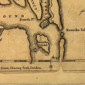 | 300 × 300 (31 KB) | Maintenance script (talk | contribs) | == Summary == Importing file |
You cannot overwrite this file.
File usage
The following page uses this file:
