

File:James-Ross-overlay-on-OpenStreetMaps.jpg: Difference between revisions
File on Ross Surname Project
More actions

Redheadkelly (talk | contribs) No edit summary |
Redheadkelly (talk | contribs) No edit summary |
||
| Line 3: | Line 3: | ||
|name= | |name= | ||
|source=Property boundaries come from land surveys published at [[North Carolina Land Grant Images and Data]]. | |source=Property boundaries come from land surveys published at [[North Carolina Land Grant Images and Data]]. | ||
|author= | |author=Own work | ||
|cat= | |cat= | ||
|description= Plot map for Rowan County land grant to James Ross from survey overlaid onto [https://www.openstreetmap.org/#map=15/35.8412/-80.2002 OpenStreetMap]. This is a guess at the location of this property based on waterways illustrated on the survey. | |description= Plot map for Rowan County land grant to James Ross from survey overlaid onto [https://www.openstreetmap.org/#map=15/35.8412/-80.2002 OpenStreetMap]. This is a guess at the location of this property based on waterways illustrated on the survey. | ||


Latest revision as of 21:53, 31 March 2026
| Description |
Plot map for Rowan County land grant to James Ross from survey overlaid onto OpenStreetMap. This is a guess at the location of this property based on waterways illustrated on the survey. |
|---|---|
| Source |
Property boundaries come from land surveys published at North Carolina Land Grant Images and Data. |
| Date | |
| Author |
Own work |
| Permission (Reusing this file) |
See below.
|
File history
Click on a date/time to view the file as it appeared at that time.
| Date/Time | Thumbnail | Dimensions | User | Comment | |
|---|---|---|---|---|---|
| current | 21:45, 31 March 2026 | 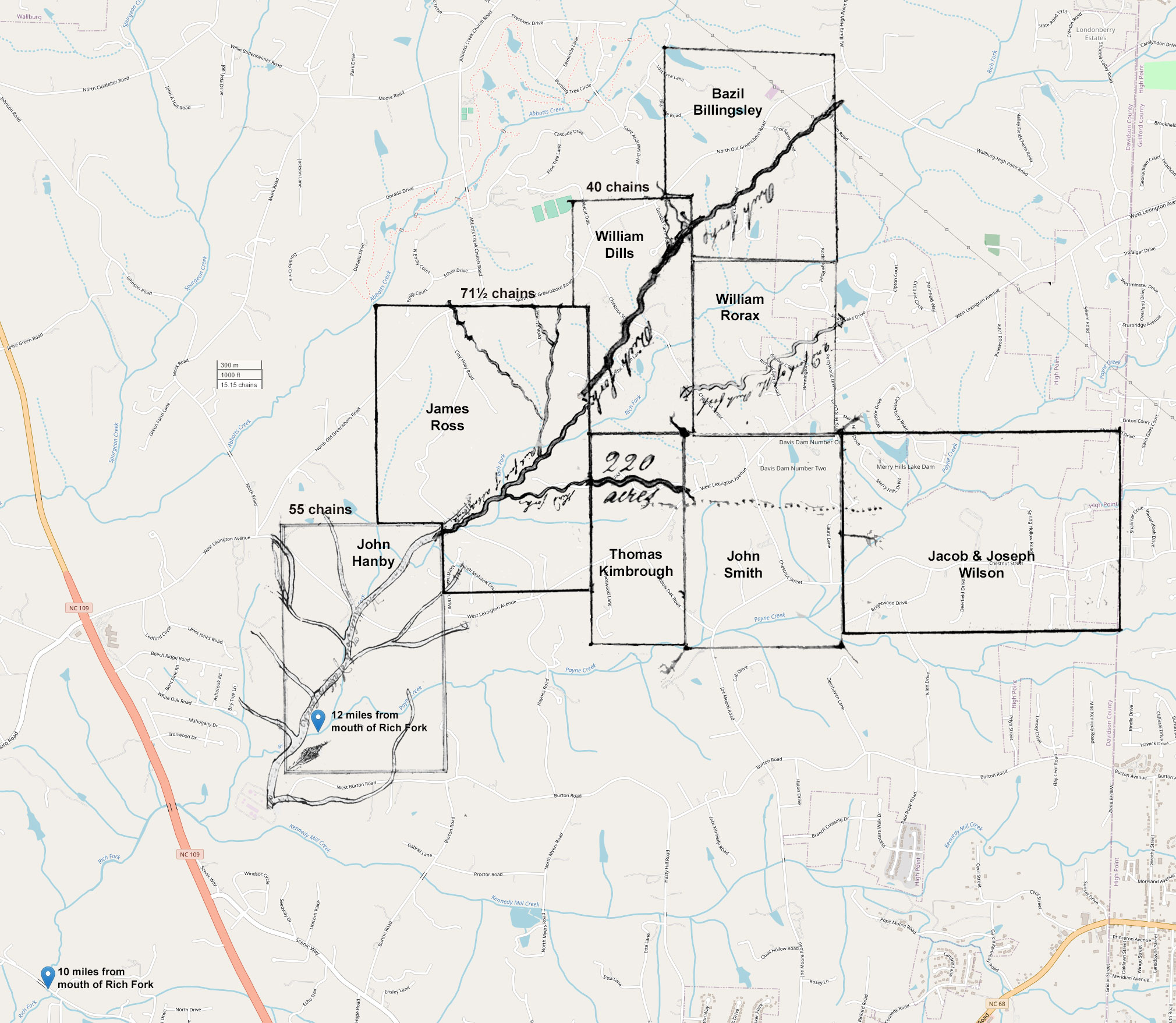 | 2,020 × 1,757 (552 KB) | Maintenance script (talk | contribs) | == Summary == Importing file |
You cannot overwrite this file.
File usage
The following page uses this file:
