

File:James-Sr-land-grant-Rowan-County.jpg: Difference between revisions
File on Ross Surname Project
More actions

Redheadkelly (talk | contribs) m 1 revision imported |
Redheadkelly (talk | contribs) No edit summary |
||
| Line 1: | Line 1: | ||
== Summary == | == Summary == | ||
Importing file | Importing file | ||
{{Information | |||
| description = Plot map for Rowan County land grant to [[James Ross Sr. of Rowan County (-1789)|James Ross]] from survey dated April 22, 1783. | |||
| source = {{cite web |title=File No. 1298, James Ross |url=https://www.nclandgrants.com/frame/?fdr=225&frm=85&mars=12.14.107.1317 |website=[[North Carolina Land Grant Images and Data]] |publisher= North Carolina Historical Records Online |via=State Archives of North Carolina, Raleigh NC, microfilm call # S.108.1019 frame 85 |access-date=12 December 2021}} | |||
| date = April 22, 1783 | |||
| author = North Carolina | |||
| permission = | |||
| other_versions = | |||
| additional_information = | |||
}} | |||
== Licensing == | |||
{{PD-USGov}} | |||
[[Category:Rowan County, North Carolina property boundary maps]] | |||


Latest revision as of 21:53, 31 March 2026
Summary
Importing file
| Description |
Plot map for Rowan County land grant to James Ross from survey dated April 22, 1783. |
|---|---|
| Source |
"File No. 1298, James Ross". North Carolina Land Grant Images and Data. North Carolina Historical Records Online. Retrieved 12 December 2021 – via State Archives of North Carolina, Raleigh NC, microfilm call # S.108.1019 frame 85. |
| Date |
April 22, 1783 |
| Author |
North Carolina |
| Permission (Reusing this file) |
See below.
|
Licensing
File history
Click on a date/time to view the file as it appeared at that time.
| Date/Time | Thumbnail | Dimensions | User | Comment | |
|---|---|---|---|---|---|
| current | 21:45, 31 March 2026 | 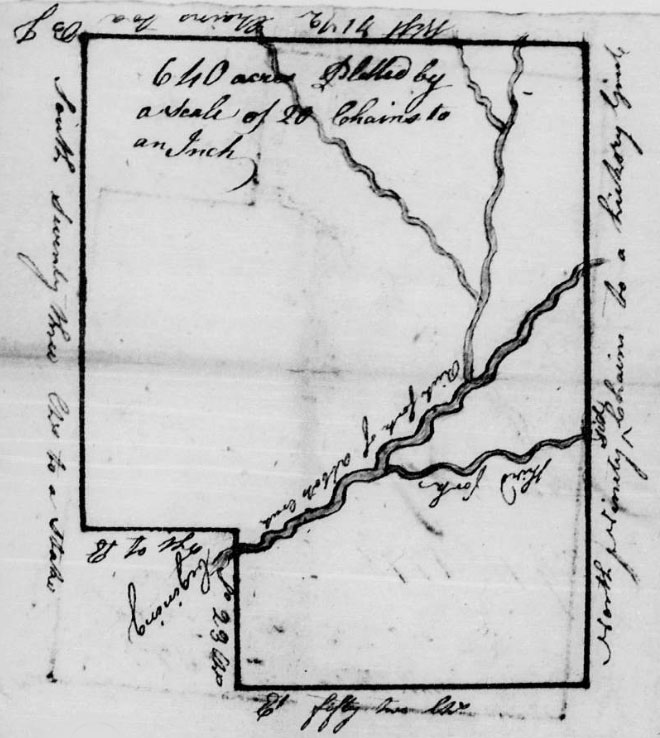 | 660 × 738 (86 KB) | Maintenance script (talk | contribs) | == Summary == Importing file |
You cannot overwrite this file.
File usage
The following page uses this file:
